SailFreeGPS, your application for easy navigation
Discover navigation made easy with SailFreeGPS! Take your own navigation instruments on your phone or tablet to experience limitless maritime adventures. The SailFreeGPS application offers you a full range of features: display of your position, calculation of course and speed, management of your waypoints, your routes, anchor alarm, and much more. Whether you are an amateur sailor or a regatta enthusiast, SailFreeGPS accompanies you with precision and reliability.
Explore the oceans confidently and freely with SailFreeGPS by your side!
The SailFreeGPS formulas
Free & PREMIUM VersionFree Version
- Totaly free
- Available for Android & iOS
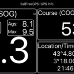
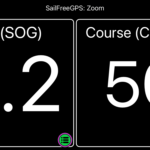
- Display of current position, speed (SOG), course (COG), maximum speed, trip distance, average speed and magnetic compass
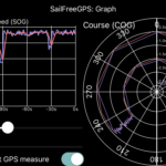
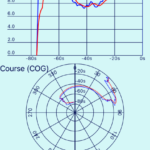
- Display of COG and SOG history (over 6 hours) to help you see the effect of your sail settings
- Filtering of GPS information for more precision (average over an adjustable set of the last measurements)
- Sharing your location, COG and SOG with your friends
- GOTO mode from position import
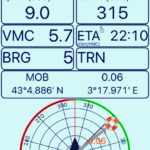
- Help in recovering a Man Over Board (MOB). It saves the position and guides you to it
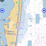
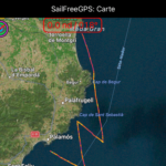
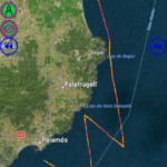
- View your journey on a map (up to 24 hours)
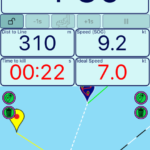
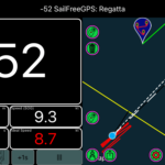
- Help during regattas with its countdown and information on the start line (distance to the line) and finish
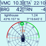
- Recording of up to 8 waypoints and GOTO function with an ETA (Estimated Time of Arrival)
- Ability to save your trip in GPX/KML format, share it and reload it
- Anchor alarm and heading alarm
- Measuring tool for distance and heading calculation
- Can be used on all types of motor or sailing boats
Premium Version
- All functions of the free version
- No advertising
GPS Info Menu
- Double click on Speed to reset distance, max and average speed
- Click long on the ROUTE to display compas
- Double click on the position to show/hide the position
Graph Menu
- Double click to switch to full screen mode
MOB Menu
- Relative heading display
- Display of tack angles
- Double click on switch to full screen mode
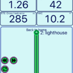
Route Menu
- Up to 100 routes
- Display of VMC and XTE (lateral distance to the center line)
Waypoint Menu
- Up to 200 waypoints
- Relative heading display
- Display of tack angles
- Double click on switch to full screen mode
Map Menu
- Speed and route display
- The color of the segments of your track depends on your speed
Anchor Watch
- The anchor area can be hexagonal and you can adjust its shape
Regatta Menu
- "Gun Button" to round the seconds to the nearest minute (to perfectly synchronize the chrono)
- Enter the exact time of the regatta start to the nearest second
- Display of time to gain/lose by keeping the same settings (speed and route)
- Display of the ideal speed to cross the line at 0:00 while staying on the same road !!!
Settings Menu
- Inverted color display (White on Black background)
- Card Type Hybrid
- Select over what duration is calculated your speed scale of your colorized track (5min, 15 min or the whole track)
- Adjust the tack angle that will be displayed on the HLM and WAYPOINT screen
Exit
- Possibility to save the track before exiting
Videos
SailFreeGPS ApplicationGeneral presentation
Route
Anchor alarm
MBTiles files (NOAA nautical charts)
Over 1 450,000 downloads
Rating of 4.5/5 on stores
Used in over 150 countries
The skippers talk about it
User reviewsExcellent app. Clear display with all the information you might need, including the MOB. Could even use it as a primary GPS if all else fails.
Great application, it’s simple, effective and intuitive. Kudos to the developer.
Simple, effective and free. Very practical app in navigation because it goes to the essentials. I particularly appreciate the recently added ETA function which is very useful for managing the timing of its navigation. The icing on the cake is that the developer listens to its users. In short, a great little app that I systematically embark on a boat
I am a seafarer. I am an observer of maritime fisheries in Senegal. We collect statistical data for our research center and this application allows me to know the position of the vessel at all times without going to the bridge to see the track plotter or the GPS. It is a very useful application for us. I am also thinking of artisanal fishing. Fishermen who go to sea in boats. The application will be very useful for them.
Great app and super easy to use! Large display of speed, course and distance data, allows real-time analysis of the impact of settings. To install and use without hesitation
Great app for us sailors. Very easy to use and especially the features like Man Overboard and drift monitoring at anchor ⚓ ⚓ very appreciated! In a word: Top!
Great app and super easy to use! Large display of speed, course and distance data, allows real-time analysis of the impact of settings. Thank you for the 8 points!!! To install and use without hesitation

My story
About Fred, Sailfreegps developerI have been a sailing enthusiast for over 25 years. My sailing history began with dinghy sailing, such as the Optimist, 420 and Laser, before I succumbed to the exhilarating sensations of windsurfing.
During my studies, I discovered sailing on habitable sailboats and I never left it. I trained at the french Glénan sailing school until I became a captain. Today, I practice sailing with family and friends during sailboat rentals. In addition, I have been the secretary of a sailing association for fifteen years, where I have the chance to introduce newcomers to the joy of living at sea.
The idea of creating this application came to me during a three-man transatlantic cruise on a 34-foot sailboat. Since then, I’ve been trying to add to it whenever I have a bit of free time. My aim is to develop an application that provides sailors with the information they need to navigate in a simple and practical way


